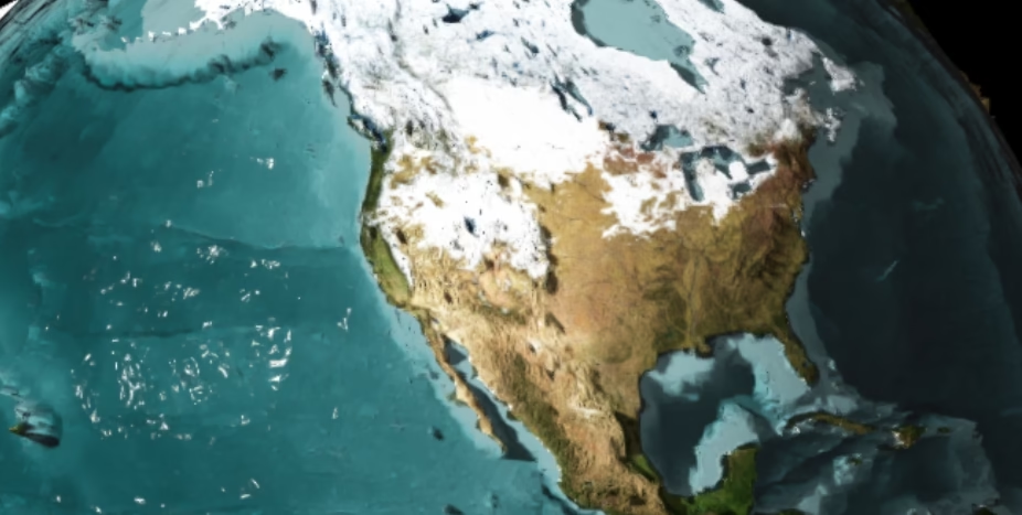
AlteredQualia’s Earth Bathymetry is a captivating interactive visualization. It uniquely and stunningly showcases Earth’s topography and bathymetry. This tool uses data from NASA’s Blue Marble project. It presents a 3D model of the planet. Users can explore its surface and underwater features with ease.
The model emphasizes the contrast between land elevation and ocean depth. Although the elevation is not to scale, it offers a more dramatic view of Earth’s geographical features. Users can interact with the model using intuitive controls:
- Z for zooming in and out,
- W to toggle water visibility,
- R for rotating the globe,
- U for ultra mode (enhancing details), and
- P to switch to photo-realistic textures.
This visualization is not only a technical feat but also an educational tool. It provides a fresh perspective on Earth’s varied terrain. It’s a perfect blend of science, art, and interactivity, showcasing the beauty of our planet through innovative design.